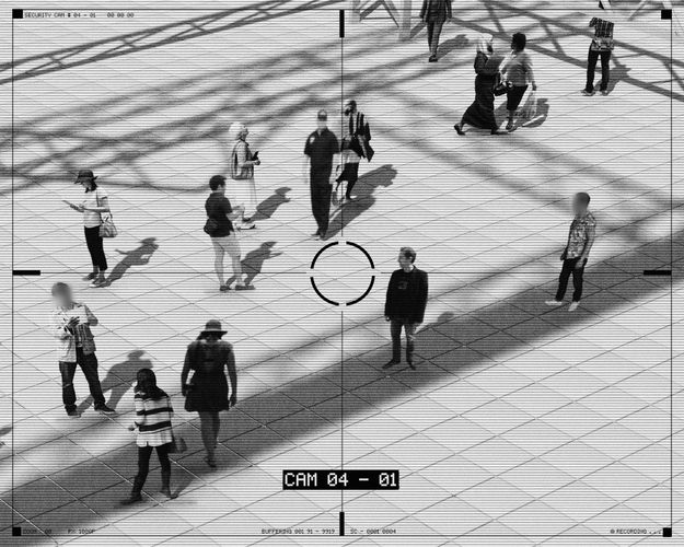
In the rapidly evolving landscape of geographic information systems (GIS), the collection and processing of visual data have become fundamental operational components. Organizations regularly capture thousands of images through street-level photography, drone surveys, and field documentation. However, with this visual data boom comes a significant compliance challenge: protecting personal information unintentionally captured in these images while maintaining their analytical value.
According to recent industry reports, over 75% of GIS projects involving public spaces inadvertently capture personal data such as faces and license plates. Under GDPR and similar global regulations, organizations face potential fines of up to €20 million or 4% of annual global turnover for improper handling of such data. The systematic anonymization of these visual datasets has therefore evolved from a best practice to a regulatory necessity.
For GIS professionals navigating this complex landscape, implementing robust photo anonymization processes isn't just about compliance—it's about building sustainable data practices that protect individuals while enabling powerful spatial analysis. This guide explores the essential components of GDPR-compliant photo anonymization in the GIS industry, from technical solutions to workflow integration.
What is photo anonymization in the GIS context?
Photo anonymization in the GIS industry refers to the systematic process of identifying and obscuring personally identifiable information within geospatial imagery. This typically includes techniques like face blurring, license plate obscuration, and the removal of other identifying features that could be linked to specific individuals.
Unlike simple photo editing, GIS-focused anonymization must maintain spatial accuracy and contextual information critical for analysis. The challenge lies in removing personal data while preserving the geographic insights that make these images valuable for mapping, infrastructure assessment, and environmental monitoring.
Advanced anonymization solutions for GIS professionals employ machine learning algorithms capable of automatically detecting and blurring sensitive elements across large photo collections, ensuring compliance without sacrificing analytical capabilities.
Why is GDPR compliance essential for drone photography in GIS projects?
Drone photography has revolutionized data collection for GIS projects, offering unprecedented aerial perspectives for mapping, surveying, and monitoring. However, these elevated vantage points create unique privacy challenges under GDPR and similar regulations.
Aerial photography captured by drones can inadvertently document private properties, gatherings, and individuals who have not provided consent for data processing. Under Article 5 of GDPR, such collection without appropriate legal basis violates core principles of lawfulness and purpose limitation.
Furthermore, the large-scale nature of drone operations—often capturing hundreds or thousands of high-resolution images in a single flight—amplifies the data protection requirements. Organizations must implement systematic anonymization workflows to process these extensive datasets compliantly before integration into GIS platforms.
Case studies from urban planning projects demonstrate that properly anonymized drone imagery can still provide valuable insights while respecting privacy rights, establishing a sustainable balance between data utility and regulatory compliance.
How does face blurring technology work in GIS applications?
Face blurring technology in GIS applications represents a specialized implementation of computer vision techniques optimized for geospatial imagery. Modern systems employ deep learning models trained specifically on the types of images common in GIS work—street scenes, public spaces, and outdoor environments—to achieve high detection accuracy even in challenging conditions.
The process typically follows three key steps. First, the system detects human faces within images using neural networks trained on diverse datasets representing different angles, distances, and lighting conditions. Second, it applies precise blurring or pixelation only to the facial regions, preserving surrounding context. Finally, it integrates the anonymized images back into the GIS workflow with appropriate metadata indicating processing status.
Unlike general-purpose photo editing tools, GIS-specific face blurring solutions must operate at scale, processing thousands of images automatically while maintaining consistent quality. They must also accommodate the unique characteristics of geospatial imagery, including variable resolutions, unusual perspectives, and environmental factors that can complicate detection.
What are the technical challenges of license plate anonymization in street-level imagery?
License plate anonymization in street-level imagery presents several technical challenges unique to GIS applications. The variety of plate designs across different jurisdictions requires robust detection algorithms capable of recognizing diverse formats, colors, and mounting positions.
Environmental factors further complicate the process, as license plates may be partially obscured by weather conditions, dirt, or physical obstructions. Angular distortion presents another challenge—plates captured from oblique angles require specialized detection approaches different from those used for frontal views.
The most sophisticated license plate blurring systems employ specialized optical character recognition (OCR) technology as a verification layer, ensuring that even partial plate information that might be reassembled through digital forensics is properly obscured. This multi-layered approach ensures compliance with GDPR Article 4's definition of personal data, which includes any information that could indirectly identify a natural person.
For large-scale GIS projects involving street-level imagery, automated batch processing capabilities become essential to handle the volume while maintaining consistent anonymization quality across entire datasets.
Can photo anonymization be automated for large GIS datasets?
Automation is not merely possible but essential for effective anonymization of large GIS datasets. Manual processing becomes impractical and error-prone when dealing with the thousands or even millions of images typical in comprehensive mapping projects.
Modern anonymization platforms designed for GIS applications leverage parallel processing architectures to handle batch operations efficiently. These systems can process hundreds of images simultaneously, applying consistent anonymization policies across entire projects while maintaining detailed processing logs for compliance documentation.
Cloud-based solutions offer particularly compelling advantages for large-scale data processing, providing scalable computing resources that adapt to project volume. This elasticity allows organizations to process seasonal or project-specific image collections without maintaining permanent infrastructure.
What data retention policies should GIS companies implement for photo collections?
GIS companies should establish comprehensive data retention policies specifically addressing visual data collections. These policies must balance operational needs with minimization principles outlined in GDPR Article 5(1)(e), which requires personal data to be kept no longer than necessary for the purposes for which it was collected.
A structured approach includes categorizing image collections based on purpose and sensitivity, then assigning appropriate retention periods to each category. For example, temporary construction documentation might warrant shorter retention than baseline infrastructure mapping.
Policies should address both raw and anonymized imagery, with stricter limitations on unprocessed images containing personal data. Many organizations implement a two-tier system where raw imagery is processed for anonymization shortly after collection, then deleted once verified anonymized versions are secured.
Regular audits of visual data storage should be conducted to identify and properly handle outdated collections, ensuring compliance with storage limitation principles while maintaining valuable historical GIS data.
How does photo anonymization impact the accuracy of GIS analysis?
When properly implemented, photo anonymization has minimal impact on GIS analysis accuracy. Contemporary techniques are designed to preserve spatial relationships, environmental context, and structural details while only modifying personally identifiable elements.
Studies comparing analysis results from original and anonymized datasets show negligible differences in key GIS applications including infrastructure assessment, urban planning, and environmental monitoring. The localized nature of anonymization—affecting only small portions of images containing personal data—ensures that most analytical value remains intact.
In some specialized applications requiring human feature analysis, anonymization techniques can be adjusted to preserve certain demographic characteristics (like approximate age groups or crowd density) while removing individually identifying features. This balance maintains analytical value while respecting privacy requirements.
Organizations using Gallio Pro and similar specialized GIS anonymization tools report maintaining 98-99% of analytical utility while achieving full GDPR compliance, demonstrating that privacy protection and data value aren't mutually exclusive.
What are the best practices for sharing anonymized GIS project photos with third parties?
When sharing anonymized GIS project photos with third parties, implementing comprehensive data processing agreements is essential. These agreements should explicitly detail permissible uses, prohibit de-anonymization attempts, and establish clear data handling expectations in compliance with GDPR Article 28.
Technical safeguards should accompany anonymized datasets, including watermarking, access controls, and audit logs tracking image usage. Many organizations implement digital rights management solutions that limit viewing capabilities or maintain anonymization integrity across different platforms.
Documentation practices are equally important—maintain comprehensive records of anonymization processes applied, verification methods used, and quality assurance steps taken. This documentation serves both compliance purposes and provides clarity to third parties about data limitations.
Consider implementing tiered access models where third parties receive only the minimum visual data necessary for their specific purposes, following the principle of data minimization while enabling collaborative GIS projects.
How do different jurisdictions regulate personal data in aerial photography?
Regulatory approaches to personal data in aerial photography vary significantly across jurisdictions, creating complex compliance landscapes for international GIS projects. While the European Union's GDPR provides comprehensive protection requiring anonymization of identifiable individuals in all contexts, other regions apply more varied standards.
In the United States, regulations follow a sectoral approach, with different rules applying based on the purpose and context of aerial imaging. Federal Aviation Administration regulations address drone operations, while state-level privacy laws increasingly impact data processing requirements for aerial imagery.
Asian jurisdictions present another regulatory model—Japan's Act on the Protection of Personal Information and South Korea's Personal Information Protection Act contain specific provisions affecting geospatial data collection, while China's cybersecurity law imposes strict requirements on data containing citizen information.
Organizations operating global GIS projects typically adopt the highest common denominator approach, implementing anonymization practices that satisfy the most stringent applicable regulations to ensure compliant operations across all territories.
What technology solutions exist for automated face detection in GIS imagery?
The technology landscape for automated face detection in GIS imagery has evolved rapidly, with several specialized solutions now available. Deep learning-based systems utilizing convolutional neural networks have largely replaced older Haar cascade classifiers, offering superior detection rates in variable outdoor conditions typical of GIS applications.
Edge computing implementations have become increasingly popular for field operations, allowing real-time anonymization during data collection through mobile and drone-mounted systems. These solutions can process imagery before it enters centralized databases, minimizing compliance risks associated with raw data storage.
For enterprise-scale operations, integrated platforms like Gallio Pro offer end-to-end workflows combining detection, anonymization, verification, and compliance documentation. These systems typically support batch processing for large photo collections while maintaining detailed audit trails for regulatory purposes.
When evaluating technology solutions, GIS professionals should consider not just detection accuracy but also processing efficiency, integration capabilities with existing GIS workflows, and adaptability to different imagery types from street-level to aerial photography.
How can GIS companies demonstrate GDPR compliance in their photo processing workflows?
Demonstrating GDPR compliance in photo processing workflows requires both procedural and technical documentation. GIS companies should maintain detailed data protection impact assessments (DPIAs) specifically addressing visual data collection and processing, particularly for large-scale systematic monitoring of public areas as outlined in Article 35.
Implementing privacy by design principles in workflow development creates demonstrable compliance evidence. This includes configuring default settings for automatic anonymization, minimizing raw image retention periods, and establishing clear data minimization practices at each project stage.
Audit trails play a crucial role in demonstrating compliance—maintain comprehensive logs of when images were collected, processed for anonymization, verified, and either deleted or archived. These logs should include processing parameters and quality control metrics to demonstrate reasonable care in personal data protection.
Regular third-party verification of anonymization effectiveness provides additional compliance assurance. Independent audits evaluating both technical implementation and procedural adherence offer compelling evidence of good-faith compliance efforts should regulatory questions arise.
Interested in seeing how Gallio Pro can streamline your GIS photo anonymization workflow while ensuring GDPR compliance? Download a demo today to experience enterprise-grade anonymization capabilities designed specifically for geospatial professionals.